Panhandle Wildflowers brochure gets an update

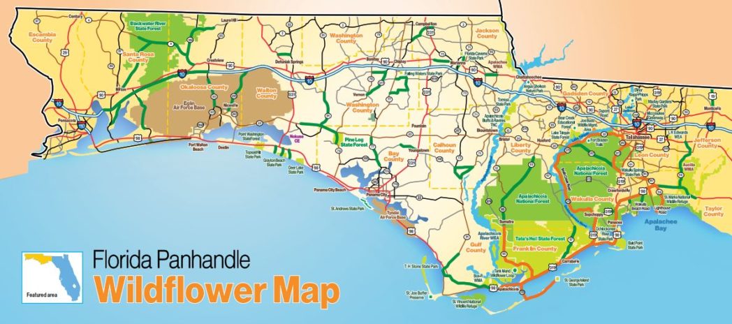
The Florida Wildflower Foundation recently published an updated Panhandle Wildflowers brochure. The publication features photos of common Panhandle wildflowers along with a map pinpointing wildflower roadsides in the Panhandle’s 16 counties, from Escambia to Jefferson. The brochure, available at Florida Welcome Centers, has been very popular with visitors and residents – more than 100,000 copies have been distributed!
The brochure features Florida Department of Transportation and county Wildflower Areas that are actively managed to conserve roadside vegetation. The Foundation plans to update the map again in the fall when more Wildflower Areas have been identified. Download the brochure now.
While most counties have roads featured on the map, routes are still needed in Escambia, Gadsden and Holmes counties. We hope to hear from Master Gardeners, garden clubs, Florida Native Plant Society members and/or other conservation-minded folks who want to to get involved in putting roads on the map.
Take Action: Save roadside wildflowers in your county! Panhandle Wildflower Alliance liaison Liz Sparks is available to provide advice on getting started. Contact her at 850-570-5950 or email liz.aparks57@gmail.com.
